Overview of Dharmapuri:
 Dharmapuri is a city in Southern India on National Highway 7 between Salem and Bangalore. Dharmapuri was called Thagadoor when King Adhiyaman ruled Kongu Nadu during 3rd century BC. He ruled Thagadoor from Adhiyaman Kottai, which is on Salem highway just outside current city of Dharmapuri. During his reign he built many temples in his kingdom. There used to exists a tunnel from Adhiyaman kottai temple to Dharmapuri Kottai temple.
Dharmapuri is the headquarter of Dharmapuri district. It was separated from Salem District 2nd October 1965. Subsequently, Dharmapuri District was again separated into two districts — Dharmapuri and Krishnagiri on 09-02-2004 due to administrative overhead in managing vast number of number of villages and townships.
The city is located 126km from Bangalore, 200km from Coimbatore, 260km from Mysore, 300km from Chennai. It is located between latitudes N 11 47’ and 12 33’ and longitudes E 77 02’ and 78 40’. The total area of Dharmapuri District is 4497.77 km2, i.e. 3.46% of Tamil Nadu.
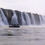 RIVERS AND IRRIGATION:
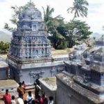 TOURIST PLACES:
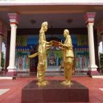